Between vines and mountains
This circuit leaves from the city of Wissembourg to reach its culminating point to the Scherhol. The return by the slopes of the piedmont offers a magnificent view of the vineyard and farmland south of the city that we will cross then.
Description
From the car park, head for the Stichaner monument.
Follow on the left the red rectangle towards the Col du Pigeonnier, along the river for 300 m then turn left the street of the water tower. Take a left again on a path then catch Turkheim street, then rue de la Décapole before entering the road on the right. After having joined the RD3 road, take the path along the path on the right, to reach M.F. Scherhol (altitude 313 m). You are on the Hochwald massif, between the Massif des Vosges and the Alsatian piedmont. Climb the path Edouard Dietenbeck and continue climbing towards the pass, always following the red rectangle.
At the junction with the yellow rectangle, follow it to the left (parallel to the red ring) to reach the Pigeonnier pass and the Club Vosgien refuge (open the WE).
Cross the RD3 carefully and, at the height of the gantry of information, enter the logging road marked green disk. Take the trail on the left down to the place called Houx Géant, remarkable tree reaching an exceptional size. Arrival on the RD77, cross it to visit the wine cellar of Cleebourg, before continuing on your left. Then always follow the green drive through the village of Steinseltz and you will return to Wissembourg by the cemetery.
- Departure : Parking, court street in Wissembourg
- Arrival : Parking, court street in Wissembourg
- Towns crossed : Wissembourg, Cleebourg, Rott, Oberhoffen-lès-Wissembourg, and Steinseltz
7 points of interest
Point de vue sur la vallée de la Lauter - PNRVN - A. Serylo  Panorama
Lauter Valley
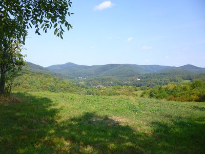
A beautiful view of the Lauter valley. In the village Weiler stands the Langenberg, a former castle from the 13th century.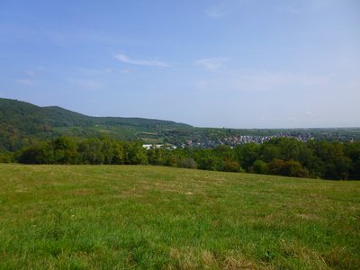
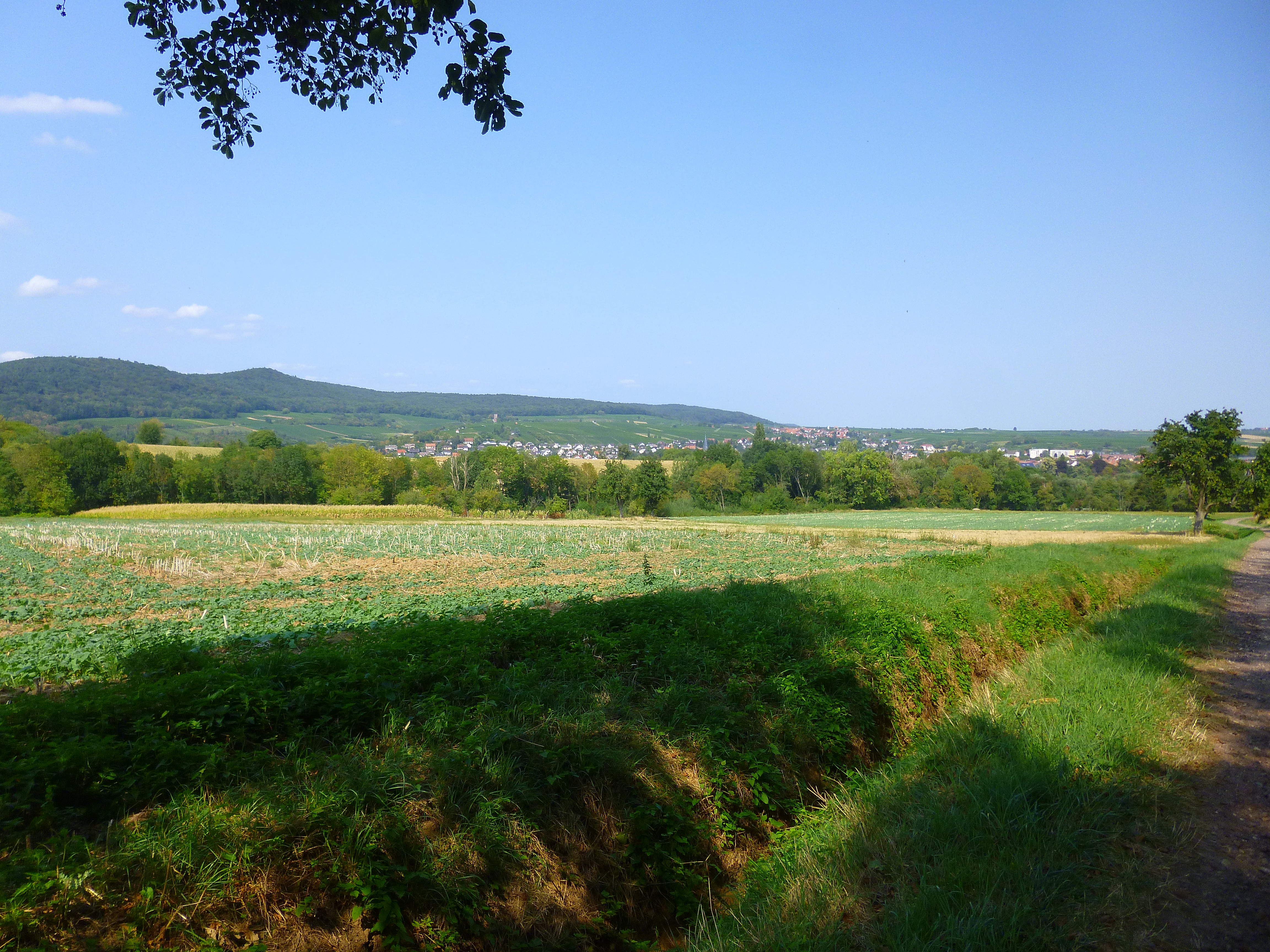
Vue sur Wissembourg et son vignoble - PNRVN - A. Serylo PanoramaWissembourg and the vineyard
Magnificent view of Wissembourg and its vineyards. In the middle of the latter stands the Château St. Paul, the last of the 4 castles built to protect the city.
Lignes de la Lauter - PNRVN - A. Serylo 
The Lauter walking trail
Decided by Marshal de Villars in 1706, they were intended to lock the north of Alsace during the war of succession to the Spanish throne (1701-1714). Thus, 50 redoubts and 28 dikes constituted a continuous parapet allowing the valley to be flooded. An important redoubt was named Maréchal de Bourg, the man who improved and increased the lines in the Scherhol area.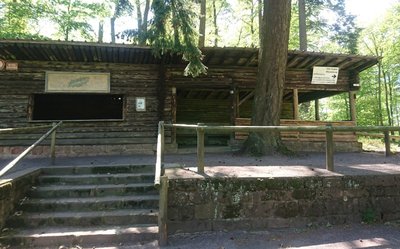
 Refuge-shelters
col du Pigeonnier shelter
Shelter and refuge of the Club Vosgien at the Col du Pigeonnier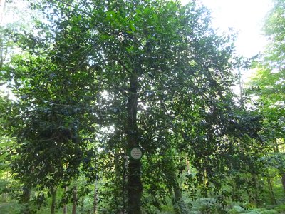
Houx géant - PNRVN - A. Serylo  Flora
FloraGiant Holly
Remarkable tree, it has an evergreen foliage, a smooth green bark, which can become light gray with age. Some become centenarians.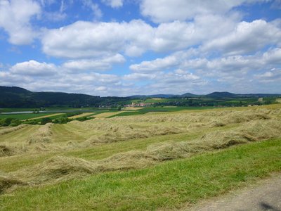
Point de vue sur Rott et le piémont des Vosges du Nord - PNRVN - A. Serylo PanoramaRott and the Vosges du Nord piedmont
A beautiful view on the village of Rott, its cultures and the foothills of the Northern Vosges.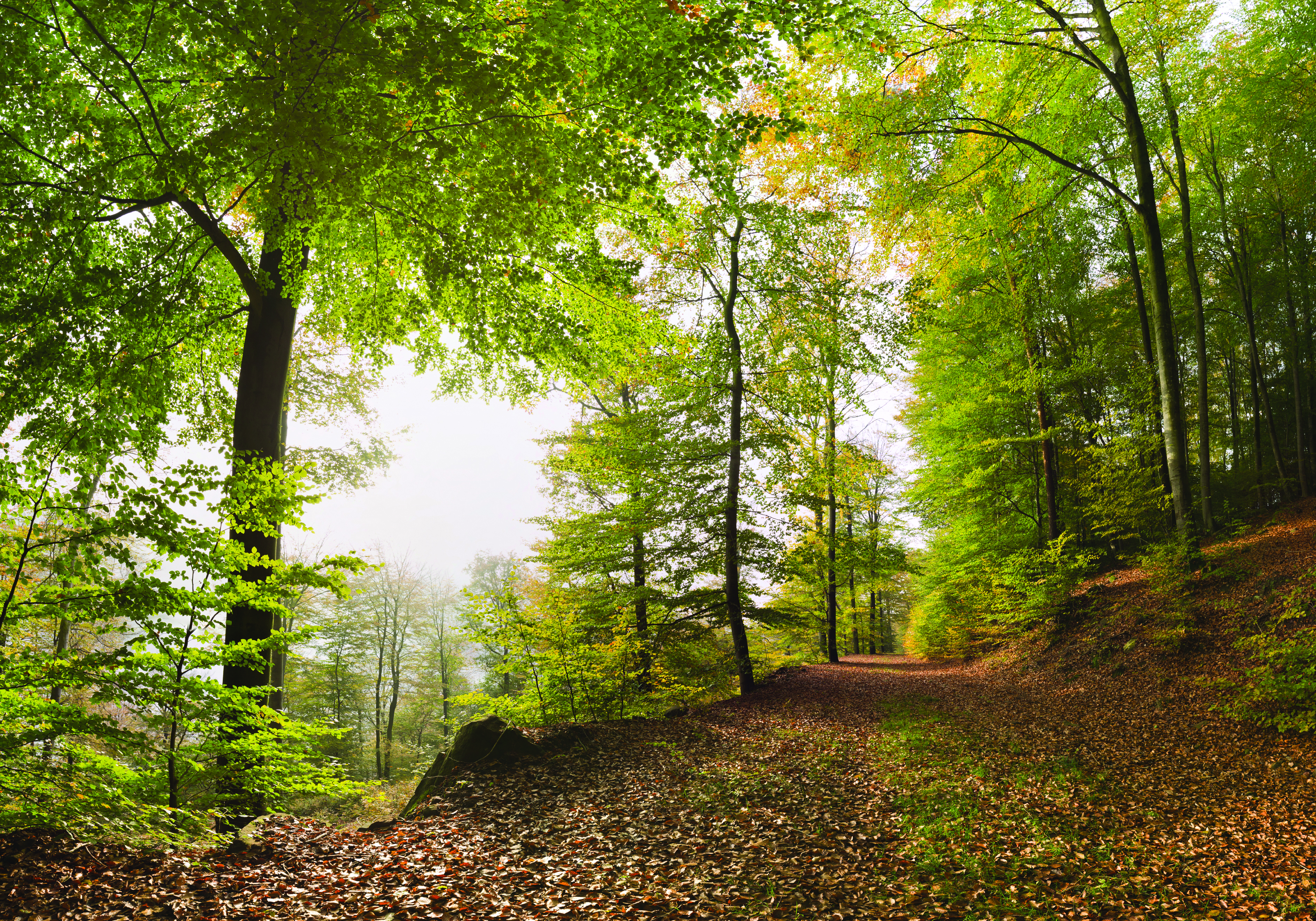
Wissembourg cemetery
One can see in this cemetery the graves of soldiers who fell at the front during the Battle of August 4, 1870. In the center of the cemetery is the tomb of General Abel Douay who was mortally wounded by a shell during this battle. Near the D264, a marker indicates the place where he fell.
Forecast
Altimetric profile
Information desks

Wissembourg Information Office - Tourist Office of Green Alsace
2 place du Saumon, 67160 Wissembourg
Access and parking
From Haguenau, take the D263 towards Wissembourg, then turn left to catch the D3.
Accessibility
- Emergency number :
- 114
Report a problem or an error
If you have found an error on this page or if you have noticed any problems during your hike, please report them to us here: