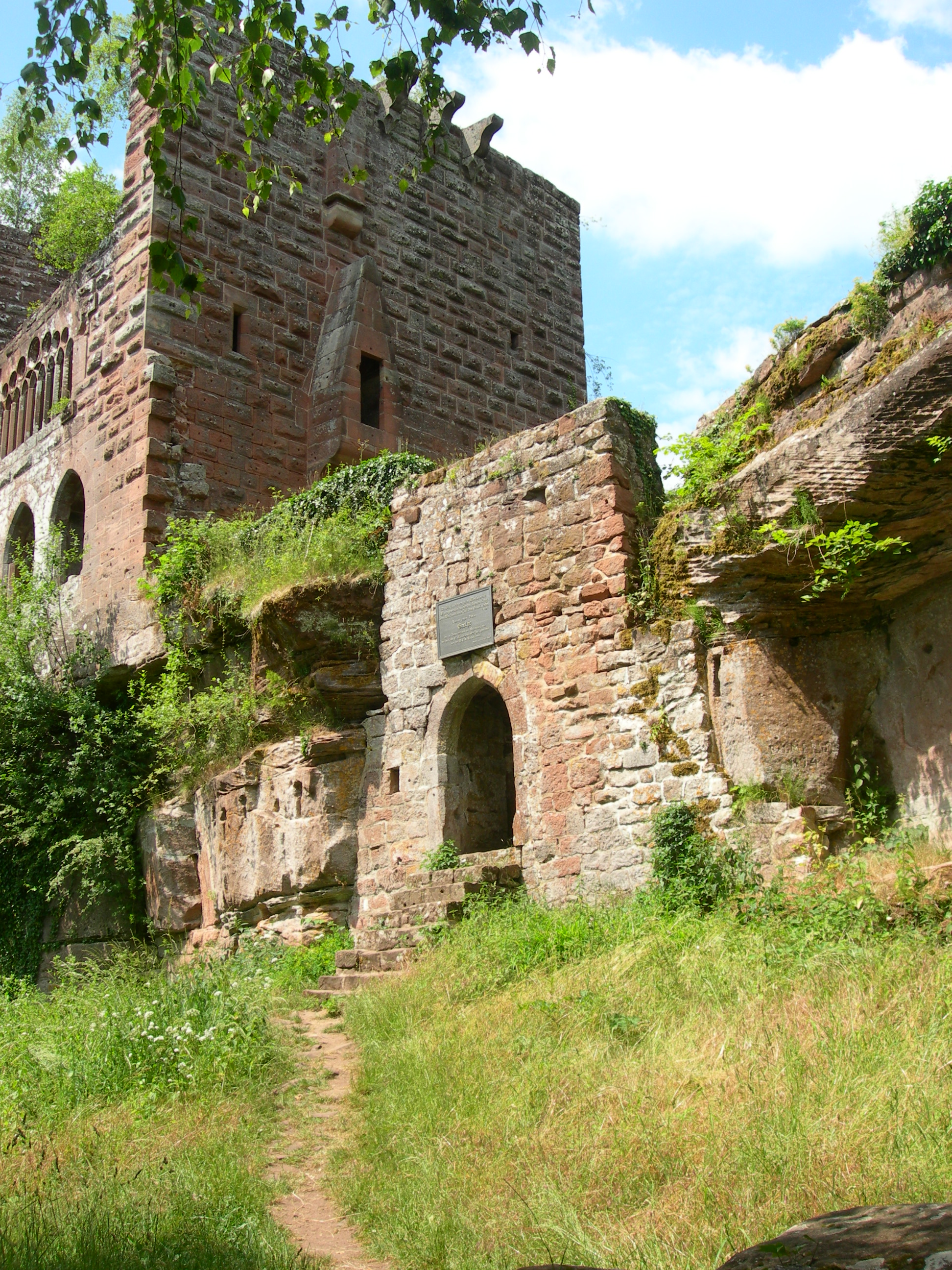
Wasenbourg circuit
In the northern Vosges, the presence of Celts that dates back to the Bronze Age, around 1500 BC. J. - C. left many traces. Long before the Romans, they began to work iron and stone. They raise menhirs, like Spitzenstein and Breitenstein in the Meisenthal region.
Near the Wasenbourg, the temple dedicated to the God Mercury or the path of the cupules stones are obvious manifestations.
Description
From the free parking rue Sister E. Eppinger, go to the Place de l'Hotel de Ville passing the ancient baths.
Follow the red rectangle towards the ruins of Wasenbourg. Walk along the Bad-Schönborn alley along the Falkensteinbach, cross the park and then the Liberation Avenue before going under the railway bridge. Turn immediately right and walk along the linden alley. After passing under the bridge of the D1062, climb on the hairpin road to the left and take the path to the left. At the forest path, climb the stairs opposite and continue climbing to the ruins of Wasenbourg.
After visiting the castle and the Wachtfelsen, take the blue road to the cup stones behind the castle. Climb the small staircase to the left. On the way, the garden of fairies and cup stones.
At the Kreuztannen junction, follow the red rectangle straight onto the Wasenkoepfel forest road.
At the next intersection, it is possible to go to the Wasenkoepfel Watchtower (detour 15-20 minutes) following the red rectangle. Then return to this junction and take the green cross trail to Buckelstein-Oberbronn.
Arrived at Oberbronn, turn left at the fountain in front of the house of 1555 following the blue rectangle towards Niederbronn. After the convent, at the corner of the rue de Wasenbourg, go left on the road between the two houses, then enter the forest. After the picnic table, take the path on the right marked blue rectangle towards King of Rome / Niederbronn. At the Mandel spring, turn left onto the Reisberg Forest Road. Pass the forest house of Reisberg then continue right on the forest path of the terminals to Niederbronn-les-Bains.
- Departure : 7, rue de la République, Niederbronn-les-Bains
- Arrival : Town 7, rue de la République, Niederbronn-les-Bains- Niederbronn-les-Bains
- Towns crossed : Niederbronn-les-Bains and Oberbronn
6 points of interest
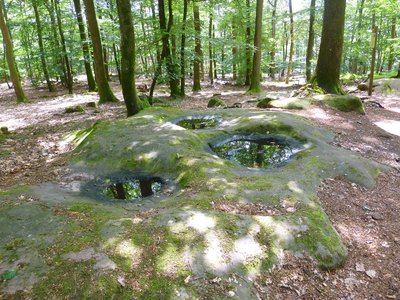
Les pierres à cupules - PNRVN - A. Serylo  Geology
Stones with cup marks
Typical geological formation of the erosion of sandstone, but which can also be the work of the human hand, they have the characteristic to be with pointed bottom instead of round or flat bottom. Almost always containing water, they are connected by small channels. Matthis believed that the altar stones, consisting of a table and a shallow cup, could have been sacrificial places.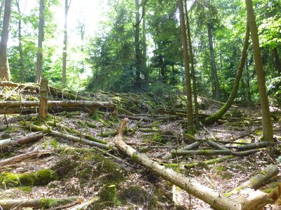
Les vestiges de l'enceinte, de 3m d'épaisseur à la base - PNRVN - A. Serylo  History
Garden of the Fairies
This rectangular enclosure, with walls 3m thick at the base, built with stones coming from nearby quarries, would date from the medieval period as the dating of fragments of tiles and pottery found on site would indicate. Historians think that it would be a fortified camp which could have been used in 1398 during the siege of Wasenbourg by the troops of the bishop of Strasbourg.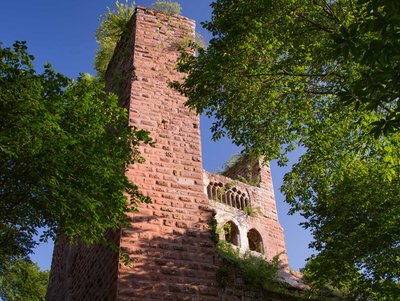
Château de la Wasenbourg - A. Dorschner  Castle-church-abbey
Wasenbourg fortified Chateau
Located on a sandstone peak at an altitude of 410 m, dating from around 1275, the castle, characterized by a 4 m thick shield wall, is strategically placed, right at the entrance to the Falkensteinbach valley. It was inhabited until the middle of the 17th century and was destroyed by the troops of Louis XIV in 1677. It is characterized by a large bay with 9 lancets, unique in Alsace, and by a frieze with a statue of a human head. It was classified as a historical monument in 1898.
 History
Rocher Wachtfelsen
Direct neighbor of the Castle of Wasenbourg, this rock still carries the traces of an old sanctuary of the heights devoted to Mercury, the god the most represented in the Vosges of North, dating from the Roman time. The rock may also have served as an observation post to guard the entrance to the valley.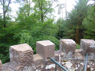
Vue du sommet sur la canopée - PNRVN - A. Serylo  Panorama
Wasenkoepfel tower
Located at the top of Wasenkoepfel, this 10 m tower dedicated to the Alsatian poet and ethnologist Auguste Stoeber was built in 1887 by the Club Vosgien. Unfortunately, in the course of time, the surrounding trees have grown, limiting the view to the canopy.
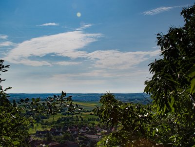
Vue sur Oberbronn et la Plaine d'Alsace - A. Dorschner  Panorama
Buckelstein Viewpoint
Forecast
Altimetric profile
Information desks
Information Office of Niederbronn-les-Bains - Head Office of Alsace Verte Tourist Office
6 place de l’Hôtel de Ville, 67110 Niederbronn-les-Bains
Access and parking
Accessibility
- Emergency number :
- 114
Report a problem or an error
If you have found an error on this page or if you have noticed any problems during your hike, please report them to us here:
